Friston Forest (UK)
LOCATION + COORDINATES
Eastbourne (UK) , Eastbourne Chalk aquifer
Chalk grassland restoration at Wilmington Downs (50.796428, 0.181419)
Heathland restoration at Lullington Heath (50.795069, 0.195033)
Chalk grassland restoration at Friston Forest (50.775908, 0.181757)
CATEGORY
Demonstration sites for infiltration restoration through forest conversion
DESCRIPTION SITE
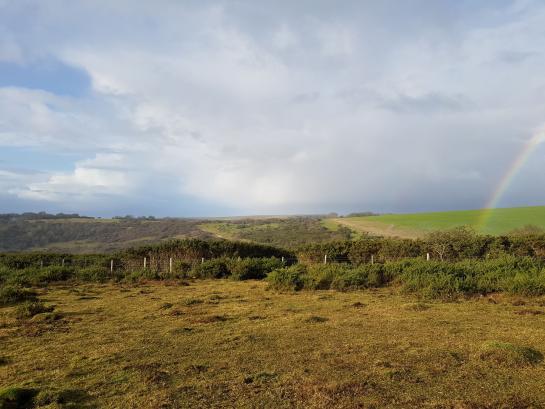
As part of the PROWATER project, South East Water (in collaboration with South East Rivers Trust and Kent County Council) temporarily opened up small pockets of woodland, gorse and scrub to allow the chalk grassland or heathland, which originally existed here, to regrow.
By implementing these Ecosystem-based Adaptation (EbA) measures, South East Water aims to help protect water quantity and quality in groundwater catchments. The targeted ecosystem services increased infiltration capacity to promote groundwater recharge and enhanced biodiversity.
The water system map helped identify areas suitable for implementing EbA measures to enhance water infiltration at the demonstration sites. Besides the expected benefits to improved water infiltration and water retention in the landscape, chalk grassland habitat is also incredibly rare and supports a range of species, some of which cannot survive anywhere else. It will take several years to return the landscape to its original state, but we are confident that over time this will lead to an increase in the number and diversity of animals living on the site – known as biodiversity.
In particular, the open areas of forest – known as glades - attract far more butterflies, moths, bats and reptiles than the wooded areas, which provide ideal sheltered feeding habitat for bat species such as brown long eared, common pipistrelle and natterers.
MEASURES
Converting high interception vegetation types (deciduous woodland, scrub and gorse) to low interception vegetation (heathland, chalk grassland) at locations of strategic importance to raw water infiltration.

TIMING
2019 - 2022
BUDGET
€ 160 352
PARTNERS
South East Water (SEW)
Kent County Council (KCC)
South East Rivers Trust (SERT)


